|
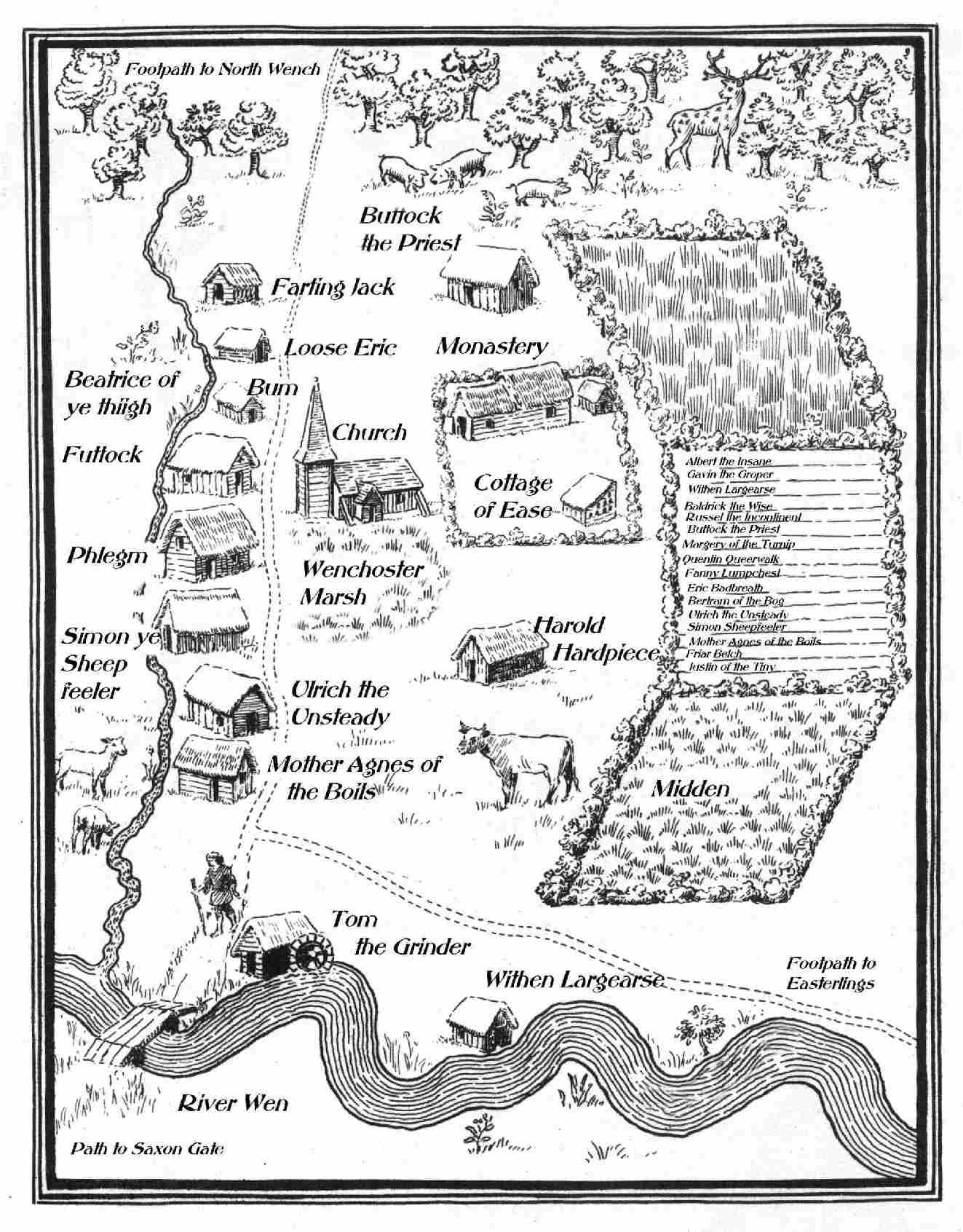
Map of Wenchoster based upon that in the "Boke of Days" by Herphastus, the Dancing Monk of Trickling Down, showing the early town, circa 950 AD and the church which fell down in 1001 AD |
|
Map of the Diocese circa 1584 showing the site of the Battle of Wenchoster Plain, 1485, and the pre-1694 western archdeaconry of "The Wet Ridings". |
|
|
|
|
|
|
|
|
|
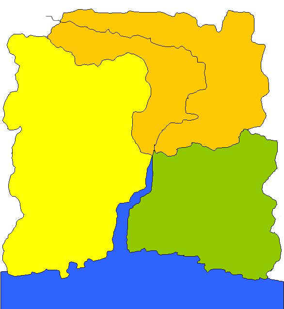
Diocesan Archdeaconry areas as set in 1694 Orange = Wenchoster Yellow = Shaston Farthing Green = Trickling Down (Map drawn by Dean of Wenchoster 2003) |
|
|
|
|
|
|
|
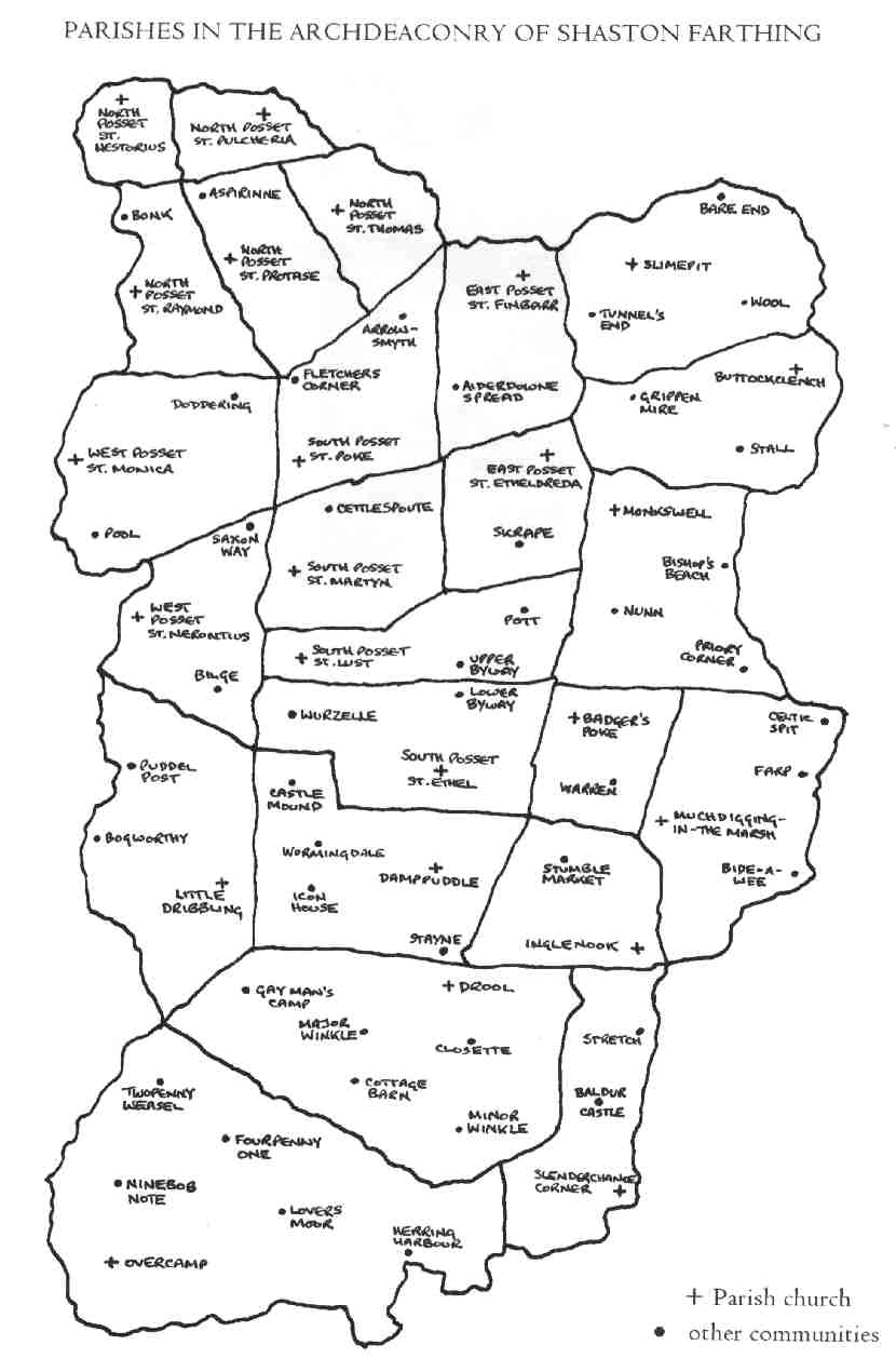
Villages of the Archdeaconry of Shaston Farthing Diocesan Ordnance Survey 1965 |
|
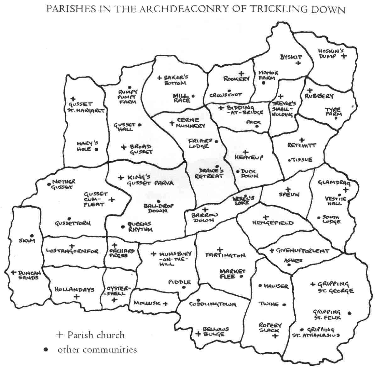
Villages of the Archdeaconry of Trickling Down Diocesan Ordnance Survey 1965 |
|
|
|
|
|
|
|
|
|
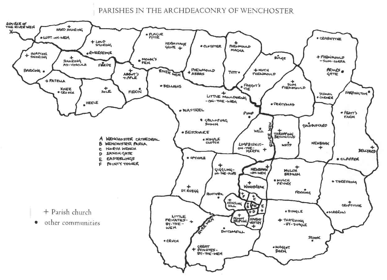
Villages of the Archdeaconry of Wenchoster Diocesan Ordnance Survey 1965 |
|
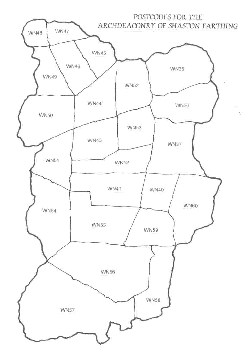
Archdeaconry of Shaston Farthing - Postcodes |
|
|
|
|
|
|
|
|
|
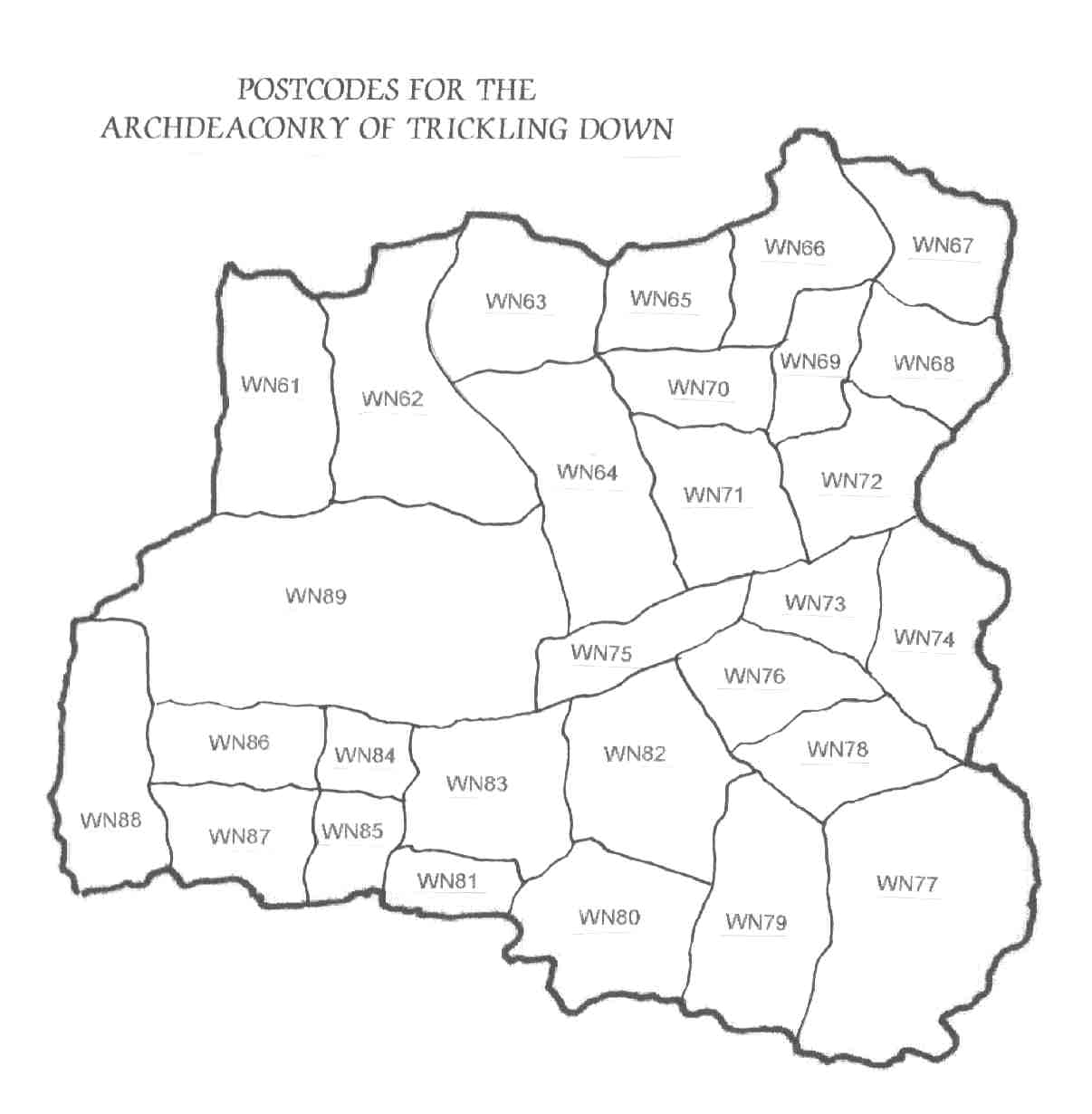
Archdeaconry of Trickling Down - Postcodes |
|
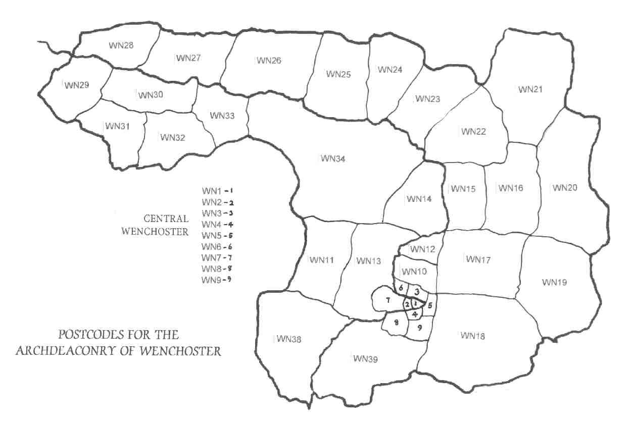
Archdeaconry of Wenchoster - Postcodes |
|
|
|
|
|
|
|
|
|
FOLLOW THIS LINK FOR WENCHOSTERSHIRE VILLAGE MAPS BY MANDYLION MAPS LIMITED |
||